Services
QUADRA Aerial imaging provides clients with orthomosaic, thermal and and multispectral images as well as bird’s eye view photographs and video that are helpful for asset management, project progress tracking and documentation.
AERIAL IMAGING
Aerial imaging offers significant advantages across various sectors, including commercial real estate, construction sites, industrial facilities, and infrastructure development.
For commercial real estate, high-resolution aerial images provide detailed insights into property layouts, surrounding amenities, and potential development opportunities, facilitating informed decision-making for investors and buyers.
In construction, aerial imagery aids in monitoring project progress, enhancing site management, and ensuring compliance with regulations by capturing real-time data from above.
For industrial facilities, aerial views can identify operational efficiencies and safety hazards, allowing for better maintenance and planning. Lastly, for infrastructure projects, aerial imaging streamlines the inspection and assessment processes, offering comprehensive overviews of large areas, which is essential for timely and effective project execution.
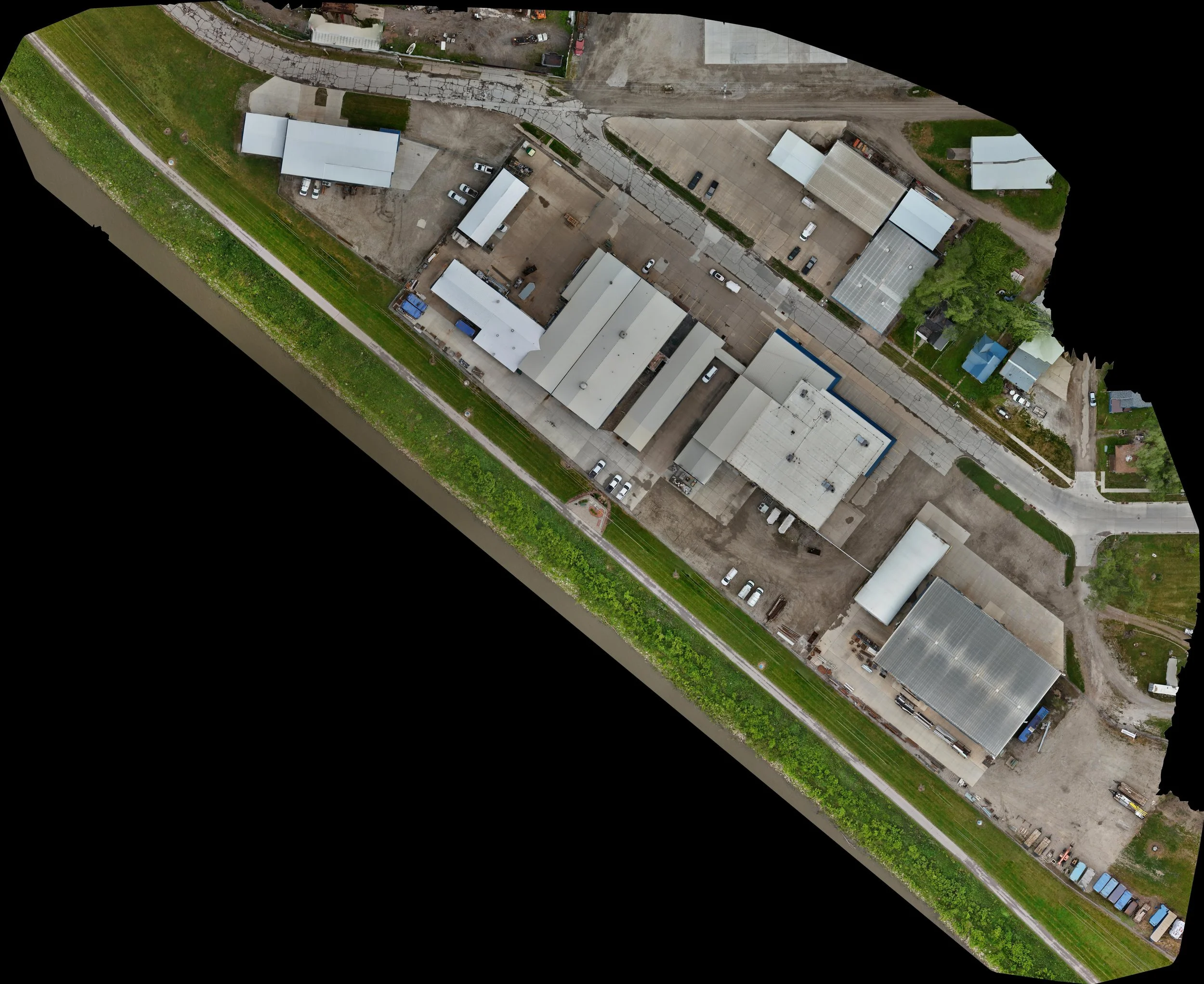
2D and 3D orthomosaic mapping using drones provides critical insights across various industries, enhancing decision-making processes and improving project outcomes.
In 2D mapping, high-resolution aerial imagery is stitched together to create a detailed top-down view, which is essential for land surveying, agricultural analysis, and urban planning. This type of mapping offers accurate representations of the terrain and features, facilitating effective site management and monitoring.
Conversely, 3D orthomosaic mapping adds depth and dimensionality to the data, allowing users to visualize elevation changes and complex structures. This capability is particularly beneficial for construction, environmental assessments, and archaeological studies, as it enables stakeholders to analyze spatial relationships and make informed assessments based on a comprehensive understanding of the terrain. Together, these mapping techniques empower industries with precise data, that can be collected quickly and cost-effectively.
MAPPING

INSPECTIONS
Drones significantly enhance the safety and efficiency of various commercial and industrial environments, including roofs, parking lots, towers, wind and solar facilities, open-pit mines, and construction sites. They allow for swift aerial inspections, reducing the need for workers to access potentially hazardous areas. This minimizes the risk of accidents and injuries while providing real-time data that aids in the identification of maintenance issues and environmental concerns. Additionally, drones improve operational efficiency by enabling precise measurements, monitoring site progress, and assessing material stockpiles, all of which contribute to informed decision-making and streamlined project management, ultimately leading to cost savings and enhanced productivity.
In addition to visual aerial inspections, other specialized types of imaging including infared and multispectral imaging which can provide another level of data that provides another level of data that can not be obtained conventionally.
Contact us
Interested in working together? Please fill out the form and we will be in touch shortly. We look forward to providing tailored solutions to meet your organization's unique needs.